Drone Solutions for Agriculture & Land Management
AviAg delivers precision drone spraying, spreading, and mapping solutions to enhance efficiency and sustainability in land management. Our drones ensure targeted application of fertilisers, herbicides and pesticides, reducing waste and minimising environmental impact.
With high-resolution aerial mapping, we proAviAg delivers precision drone spraying, spreading, and mapping solutions to enhance efficiency and sustainability in land management. Our drones ensure targeted application of fertilisers, herbicides and pesticides, reducing waste and minimising environmental impact.

Spraying and Spreading
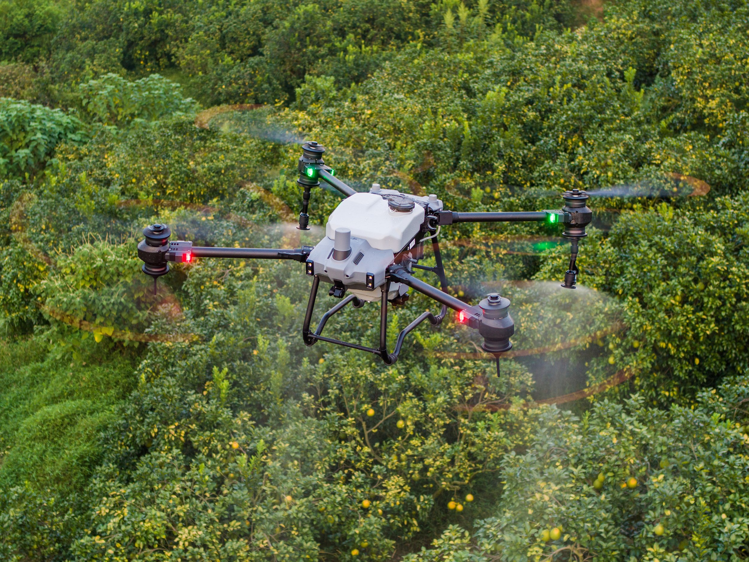
Our drone spraying and spreading solutions enhance land management by preventing soil compaction, improving efficiency, and maximising yields. Unlike heavy machinery, which can exert pressures of around 100-200 kPa on the soil, leading to up to 15% yield losses, drones operate above the ground, preserving soil health and root growth.
With precision application, drones can reduce chemical waste by up to 30%, ensuring even nutrient distribution and healthier crops. They also enable timely treatments in wet or inaccessible areas, helping landowners boost productivity, cut costs, and protect soil for the future.

Mapping
Aerial mapping enhances land assessment and decision-making by using high-resolution drone imagery to detect soil health variations, crop stress, and environmental risks. Techniques like NDVI mapping reveal plant stress early, allowing for proactive land management to prevent potential yield losses.
By identifying precisely where resources are needed, drone mapping reduces waste, improves efficiency, and lowers costs. It also supports water management, erosion control, and infrastructure planning, making it a critical tool for sustainable and high-yield agriculture.
Contour/Topography Mapping
Understanding your land’s contours and elevation changes is essential for effective planning, water management, and soil conservation. AviAg’s Contour & Topography Drone Mapping provides high-resolution elevation data, helping landholders optimise farm layout, prevent erosion, and improve drainage strategies.
Using advanced drone technology, we create detailed, accurate topographic maps that give you a clearer picture of your property. Whether you’re designing irrigation systems, managing run-off, or planning infrastructure, our mapping services ensure smarter, data-driven decisions—saving you time, reducing costs, and maximising productivity.