
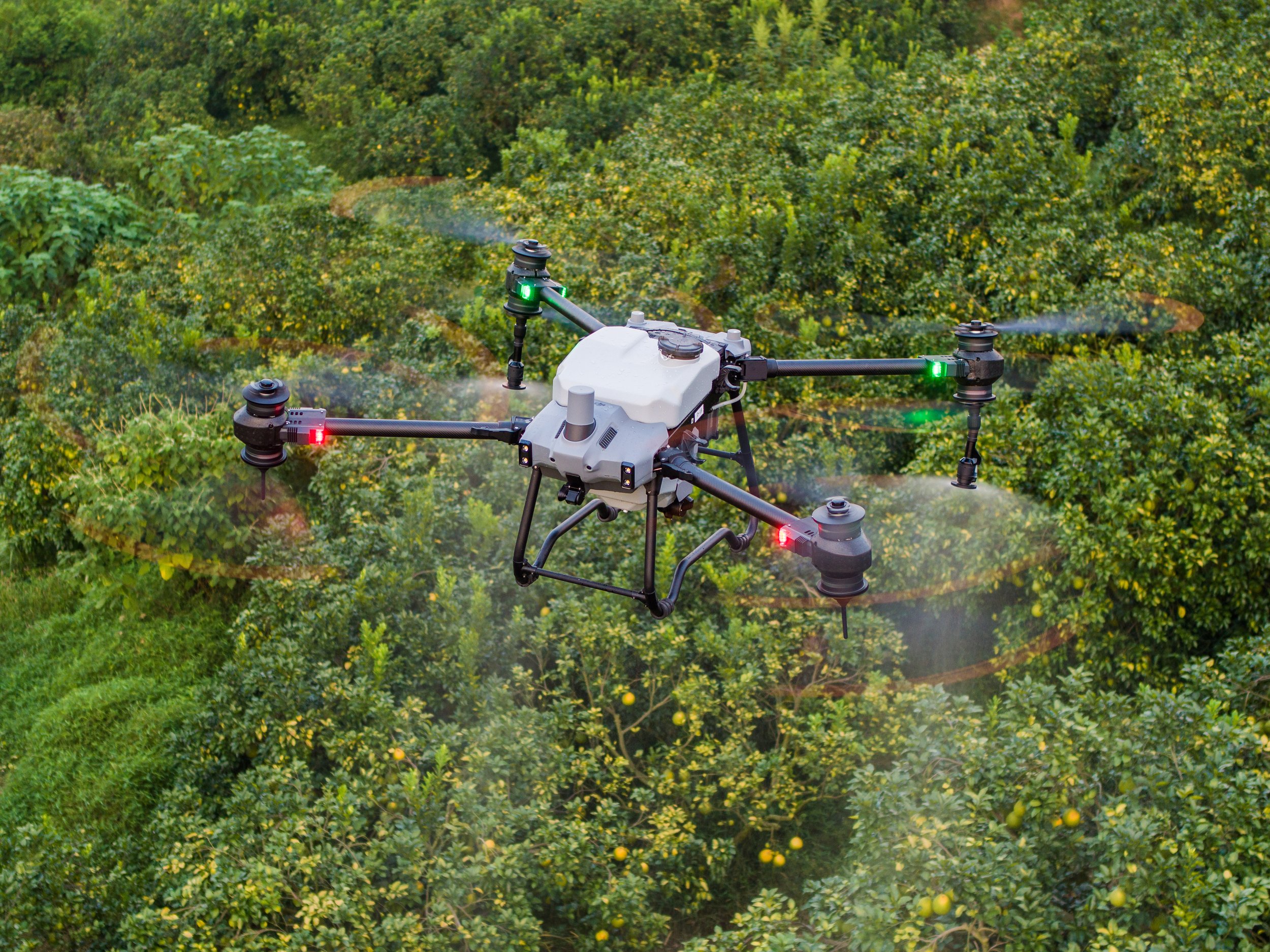
Drone Mapping
Effectively scan and analyse crop growth with total clarity. AviAg produces high definition maps with RGB and Multispectural images, using RTK Precision.

Mapping Services
AviAg’s drone mapping services are focused on helping land owners and farmers effectively and comprehensively map out their properties. Through advanced topographic mapping drone solutions, we are able to help our clients carry out aerial surveys, monitor crop growth, and conduct multispectral mapping.
We are located in Yackandandah, Victoria, but customers from northeast Victoria and southern NSW areas can also take advantage of our drone mapping solutions. Our services are available in Beechworth, Chiltern, Indigo Valley, Albury, Wodonga, Kiewa, Rutherglen, Stanley, Tangambalanga, Corowa, Glenrowan, Holbrook, Chiltern, Wangaratta, Bright, Myrtleford, Kiewa, Tallangatta Valley, Mt Beauty, Towonga, Khancoban, and Alpine Valley.
We also provide drone mapping services for large scopes of work in Wagga Wagga, Tumut, Shepperton, and Tocumwal areas.
Contour & Topography Drone Mapping: Precision Insights for Smarter Land Management
Understanding the natural contours and elevation changes of your land is crucial for effective planning, water management, and long-term sustainability. AviAg’s Contour & Topography Drone Mapping service provides highly detailed elevation data, helping landholders make informed decisions that enhance productivity while reducing risks associated with poor drainage, soil erosion, and inefficient land use.
How It Works
Using advanced drone technology, we capture high-resolution aerial imagery and elevation models to create accurate topographic maps of your property. These maps provide detailed insights into land gradients, slopes, and low-lying areas, allowing you to visualise your land like never before. Unlike traditional land surveys, drone mapping is faster, more cost-effective, and highly precise, giving you real-time data with minimal disruption to your operations.
The Benefits of Contour & Topography Drone Mapping
Optimised Water Management – Proper drainage is essential for crop health and soil stability. Our mapping helps identify areas prone to waterlogging, allowing you to plan effective run-off and irrigation systems to prevent flooding and improve water distribution.
Soil Conservation & Erosion Control – By understanding land gradients, you can implement erosion control strategies that prevent soil degradation and maintain long-term soil health.
Infrastructure Planning & Development – Whether you're constructing roads, fences, or new facilities, having accurate topographic data ensures efficient planning and cost-effective execution.
Maximised Land Use Efficiency – Knowing the natural layout of your land allows you to strategically plan paddocks, grazing areas, and crop fields for higher productivity and sustainability.
Fast, Accurate, & Cost-Effective – Traditional survey methods can be time-consuming and expensive. Drone mapping delivers quick, precise, and high-quality data, reducing the need for extensive fieldwork.
Services
-
Mapping is a valuable tool for modernising agricultural practices, enhancing productivity, and ensuring sustainable land management. By leveraging spatial data and technology, agriculture professionals can make informed decisions to optimize resource use, reduce environmental impact, and increase profitability. Clients can identify yield variations, asses the effectiveness of management practices, and make informed decisions for future planning and harvesting activities.
-
Drones equipped with multispectral cameras can efficiently capture high-resolution images of large areas. These images can be quickly processed to generate detailed maps highlighting areas of concern. This technology is particularly useful for creating targeted spray maps, where pesticides or fertilizers are applied only where needed, reducing waste and environmental impact.
Overall, the integration of multispectral imaging technology into agriculture offers tremendous potential to increase efficiency, productivity, and sustainability, ultimately benefiting farmers and the environment alike.
-
Multispectral images can provide detailed information about the health and vigour of crops. By analysing different wavelengths of light, clients can identify stress factors such as nutrient deficiencies, water stress, diseases, or pest infestations. This allows for timely intervention, optimizing resource allocation and minimizing yield losses and cost.
-
Mapping the topography of land helps in identifying areas prone to erosion, waterlogging, or poor drainage. This information is crucial for designing effective land leveling, drainage, and irrigation systems to improve crop productivity.
-
By evaluating the condition of an asset, organisations can make informed decisions regarding maintenance, repairs, replacements, and overall management strategies. This process involves collecting data about the assets current state, performance, and any potential issues that may impact its functionality or longevity. It enables organisations to optimise maintenance schedules, extend asset life, and ensure the operational efficiency over the assets life cycle.
-
Travel is an inherent part of working in a specialised industry, and to ensure we can serve a broad range of landholders, AviAg covers a 100 km radius form Albury/Wodonga with no extra charge for travel. Travel beyond that is still no issue, and can be worked into a contract with each client.
-
No, it is not strictly necessary to map all drone jobs, but at AviAg we find mapping can offer significant benefits which can improve efficiency, accuracy, and data management. Whether or not we map your spray jobs depends on the specific needs of your operation, the scale of the field, and your goals for precision and resource management.
AviAg provides complimentary mapping for jobs where we believe it will be beneficial.
-
The cost of using AviAg's drone services can vary based on several factors, such as the size of the area to be treated, the type of service required (e.g. mapping, spraying, spreading, or other precision ag tasks), and the specific conditions of the field.
AviAg primarily operates on an hourly rate for most jobs, however a hectare rate for applications in crops can be discussed. We find this structure works best for both our clients and us as service providers.
-
At AviAg, we strive to serve as many landholders as possible, so don’t hesitate to contact us, even if you think your job might be too small. While we typically operate with a minimum of half a day, we’d be happy to discuss your project and see how we can assist you.
FAQs
Book a free quote